Friday, April 22, 2011

Lab 9

A Map of the age distribution of Bowling Green, along with classification of roads

GIS Lab 7

This isn't a very pretty final layout, but it was my first time georeferencing and placing points by address.
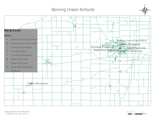
Historic Map

This is a Historic Map of Savannah, GA, georectified to a current city map and DRG.

Castalian Springs

I took a scanned map of the town of Castalian Springs, TN, and georectified it to a NED.  I then created a hillshade, and digitized the Tornado's path, damaged sites, and the damage zones.

Friday, March 4, 2011

Lab 8

Here is my last lab before spring break, its just a couple different maps of Wood County.

Wednesday, March 2, 2011

SEES Project 2

This is the newest project we did.  We had to find a location for Tiger Woods to build his PGA golf course, with stipulations.  It had to be in a county with a major highway running though it, within 75 miles of a city with a quarter million residents or more, within 50 miles of a military base, within 10 miles a body of water, and in an area with land use zoned for something suitable to build a golf course on.

Tuesday, February 22, 2011

SEES 3000, first project

Population Density of Savannah, GA.  Going to be doing a lot of projects about Savannah in this class.